
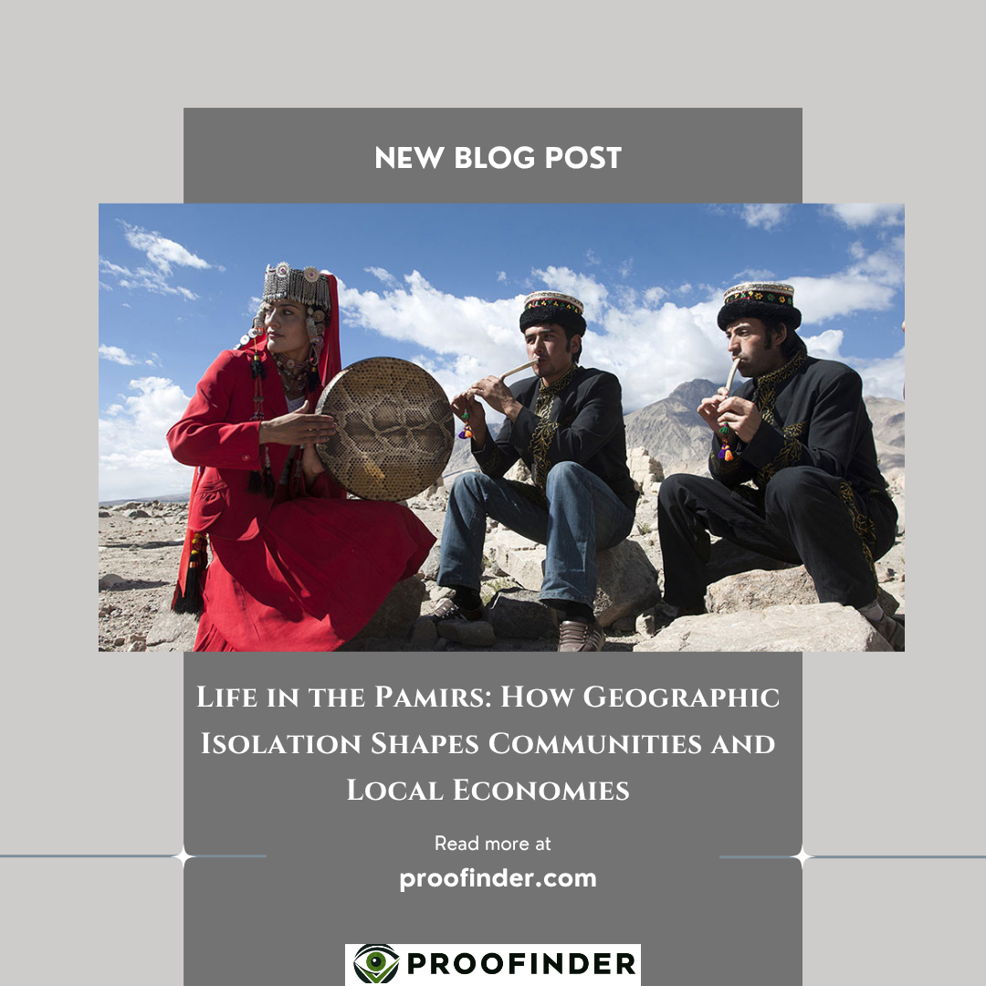
Life in the Pamirs: How Geographic Isolation Shapes Communities and Local Economies
The Pamir Mountains region – especially Tajikistan’s Gorno-Badakhshan Autonomous Region (GBAO) – exemplifies how extreme terrain and isolation shape community life and economies. GBAO covers about 45% of Tajikistan’s territory but holds only ~3% of its population (≈227,000 people). Most residents are ethnic Pamiris who speak Eastern Iranian “Pamir” languages (e.g. Shughni, Rushani, Wakhi) alongside Tajik/Russian. The region’s climate and topography – with peaks above 7,000 m and frigid winters – dictate a traditional agropastoral livelihood: scarce irrigated fields in valleys support potatoes, barley and fruit trees, while households drive sheep, goats, yak and even reindeer on seasonal high pastures. Men often migrate for work (many to Russia), and remittances form a crucial income source – in fact, Tajikistan’s remittances reached ~48% of GDP in 2024.
Transport in the Pamirs is arduous. GBAO is linked by the Pamir Highway (the M41 route) to Osh (Kyrgyzstan) and Dushanbe, and since 2004 by a Chinese-built road over the Kulma Pass to China. These roads are often unpaved and blocked by snow/landslides. Flights to Khorog (GBAO’s capital) are seasonal. By contrast, Afghanistan’s Wakhan Corridor (just south of GBAO) has no road access, and winter snows fully cut it off. This isolation means local markets are tiny and outside links rely on traders or NGOs. Many GBAO communities depend on cross-border trade (e.g. with Kyrgyzstan and Afghanistan) and foreign aid (notably from the Aga Khan Foundation and EU/UN programmes).
Despite hardship, cultural traditions and community institutions endure. Pamiris are predominantly Ismaili Shia Muslims (followers of the Aga Khan). Local NGOs and civil society (e.g. volunteer centres, women’s cooperatives) play an outsized role in education, health and social support. In tourism, the Pamirs see only niche adventure travelers (biking, trekking or cultural tours), but local groups like the Pamir Eco-Cultural Tourism Association (PECTA) are building eco-cultural routes to benefit villages. This report details GBAO’s geography, population, economy and challenges – and compares them briefly with the Afghan Wakhan – to illustrate how isolation shapes life on the “Roof of the World.”
Geographic Setting and Climate
The Eastern Pamirs (Pamir Mountains) are among Asia’s highest plateaus. GBAO includes peaks up to 7,700 m (Ismoil Somoni Peak) and extensive glaciers. Over 60% of Central Asia’s glaciers lie in Tajikistan, many in GBAO. These ice fields feed rivers (like the Panj/Amu Darya) but also create hazards: glacial retreat, lake outburst floods and mudflows are intensifying under climate change. For example, in 2015 a glacial lake burst inundated villages in GBAO. Geography: most villages lie in narrow river valleys; beyond the fields there are alpine meadows and rock. Summers bring green pastures, but winters see heavy snow. One UNDP report notes that mountain communities face floods, landslides and water shortages linked to glacial melt.
GBAO’s climate is cold and semi-arid. Higher elevations have tundra or permanent snow. At lower altitudes (2,000–3,000 m) summers are short but allow limited farming. In winter, isolation is extreme: road passes close to Khorog often close under snow and avalanches. For instance, a traveler notes the Dushanbe–Khorog road can take 15–20 hours by car on unsurfaced mountain roads prone to closures. Wakhan’s terrain is even more forbidding; in Afghanistan it is bounded by Hindu Kush and Pamir peaks, and locals report “no road access here”, with villages cut off for months each year. Seasonal river crossings (footbridges, coracles) connect Wakhan villages, but cannot support vehicles.
People, Languages and Culture
Gorno-Badakhshan’s population (~227,000 in 2019) is overwhelmingly Pamiri (Northeastern Iranian) ethnolinguistic groups. Multiple related languages are spoken: Shughni is the largest, along with Rushani, Wakhi, Ishkashimi, Yazgulyam, Sarikoli, and others. Many Pamiri people are multilingual, also using Tajik and Russian for administration. Most are Ismaili Shia Muslims (followers of the Aga Khan), which distinguishes GBAO religiously from Sunni-majority Tajikistan. This shared faith supports strong community institutions (the Ismaili Jamatkhanas, local councils, and NGOs).
Wakhan’s inhabitants are mostly Wakhi (a Pamiri group) and some Kyrgyz. They speak Wakhi (Eastern Iranian) or Kyrgyz, in addition to Dari (Afghan Persian). In remoteness and livelihood, Wakhan tribes resemble Tajik-side Pamiris: agro-pastoralists in mountain villages. Most people live in tiny settlements (often just a few dozen families) with subsistence farming. The combined Afghan Wakhan Corridor has only about ~15,000 residents. Like their Tajik neighbors, Wakhanis follow traditional practices – many are also Ismaili (the region straddles the Afghan-Tajik Ismaili community) – but they get virtually none of the services found in Tajikistan. A 2021 report notes Wakhanis “have no healthcare, education or other services” and suffer chronic malnutrition from lack of food diversity.
Transport, Connectivity and Infrastructure
Road Access: The Pamir Highway (M41) is GBAO’s lifeline. Built mostly in the Soviet 1930s, it runs from Tajikistan’s south (Osh border) through Khorog to Dushanbe. It also connects via China: in 2004 a Chinese-funded road over Khunjerab/Kulma Pass linked Khorog to Kashgar. However the highway is often unpaved or damaged by landslides. Recent efforts (a World Bank/CARs project) are upgrading sections and disaster-proofing it. In late 2022 a Chinese firm began a $200M overhaul of 100 km of Pamir highway near Khorog. Seasonal disruptions remain, so flight service (Khorog airport) is prized but also infrequent.
In contrast, the Wakhan Corridor has only footpaths and mule tracks. There are small border outposts (e.g. Ishkashim on Tajik side), but no paved road crosses Afghanistan’s Pamir. Even Tajikistan’s Wakhan-adjacent Ishkashim district is reached by river bridge or footbridge – limiting trade. Thus market access is minimal in winter. Border Controls: GBAO’s Khorog–Ishkashim crossing to Afghanistan has a bridge (built by Aga Khan Foundation), open seasonally for limited traffic. To Kyrgyzstan and China the Pamir Highway has official checkpoints. Cross-border trade is modest: local traders export livestock and informal goods, but much high-value trade (fuel, mining) is dominated by outsiders.
Livelihoods and Economy
With negligible industry or large farms, GBAO communities depend on diversified subsistence strategies. Farming: In valley oases (e.g. Roshtqala, Khargush), families cultivate barley, wheat, potatoes, vegetables and fruit trees using mountain irrigation. However land is very limited, so yields usually meet only family needs. Pastoralism: Most households keep flocks of sheep/goats and some yaks. A typical Pamiri economic system is “integrated crop-arboriculture-livestock”. Villagers take all their animals to high alpine “ailoĥ” summer pastures, then stall-feed them on hay over winter. Women often manage the dairy processing (yogurt, qurut) from animal milk. Export of wool or meat is small-scale; one report notes yak products are mostly for home use, though some meat is now sold at markets.
Handicrafts and Small Enterprise: Many families supplement income through craftsmanship. In Roshtqala and other districts, women spin wool, weave carpets or embroider traditional clothing. For example, one Wakhi woman, Alimabonu Dovutova, turned home sewing and knitting into a small workshop selling products in Khorog and Dushanbe markets. NGOs have trained hundreds of Pamiri women in business skills, helping launch small bakeries, sewing shops and food processing enterprises. These cottage industries preserve culture and provide cash when men are away.
Migration and Remittances: A huge share of young men work abroad (mostly in Russia), sending remittances home. Across Tajikistan over a million migrants send money (≃48% of GDP), and GBAO has among the highest migrant rates in the country. Remittances fund household expenses, housing, and education. During the Soviet era GBAO had some mechanized agriculture (state collective farms), but that collapsed after 1991, amplifying reliance on labor migration.
Markets, Aid and Trade Networks
Because of isolation, GBAO has few large markets – Khorog’s bazaar is the main hub. Essential goods (fuel, salt, sugar) are trucked in. Much trade is informal. A local NGO (Milan-Inter) helped create cross-border “Silk Road” markets linking traders from GBAO, Afghanistan and Kyrgyzstan. Aid organizations (AKF, GIZ, UN agencies) effectively subsidize the economy. For instance, AKF built five bridges and hosts the region’s main hospital and schools.
In Wakhan, trade is almost nonexistent. Some Wakhi and Kyrgyz families keep cashmere goats; Afghan border crossing to Tajikistan allows small-scale barter. There is almost no organized market; humanitarian aid (from Aga Khan and UN) provides the bulk of what cash and services exist.
Tourism and Cultural Opportunities
Tourism is nascent. GBAO’s spectacular landscapes, Ismaili culture and Silk Road heritage have attracted adventure travelers. Groups like the Pamirs Eco-Cultural Tourism Association (PECTA) promote homestays, cultural tours and mountain trekkingSmall guesthouses exist in Khorog and district towns. However, in 2011 only “a few tourists” reached GBAO due to remoteness. Growth is cautious: emphasis is on eco-tourism that benefits locals without damaging culture or environment. In the Wakhan Corridor, tourism was virtually zero until the 2020s due to conflict, but some wariness exists that responsible trekking could aid local incomes (as one analysis notes, Wakhan’s pristine wilderness is “stunningly beautiful” and could appeal to adventurers).
Public Services and Governance
Public services in GBAO lag behind national standards. Health clinics are sparse: until recently villagers often endured long journeys for care. In 2026 UNICEF/EU reopened a regional hospital’s infectious disease ward and a rural clinic in Birdibaev (Murghab) serving ~2,000 residents. Education is better developed: GBAO has multiple gymnasiums and a university (set up by AKF) in Khorog, but remote villages struggle with teacher shortages and limited textbooks. Electricity comes from small hydropower plants, but many hamlets rely on generators or wood stoves.
GBAO is “autonomous” by constitution, but the president appoints the governor. Local people often feel decisions come from Dushanbe. In practice, civil society (NGOs, community councils, Jamatkhana networks) takes a large role in development and social order. In Wakhan, there is no effective local governance from Kabul; day-to-day life is regulated by elders and (until recently) by local militias. Formal government presence is minimal, and services are almost entirely NGO-provided if at all.
Climate Change and Environmental Risks
Climate change poses a grave threat. Tajikistan’s mountains are warming faster than the global average. GBAO’s thousands of glaciers are receding, reducing summer water for irrigation and hydropower. UNDP notes that “more than half of Central Asia’s glaciers could disappear by 2050” without climate action. In GBAO, this means increased flood risk (glacial lake outbursts have already destroyed villages), soil erosion, and water scarcity affecting crops and livestock. Communities are responding with communal early-warning systems and climate-resilient agriculture projects funded by UN/EU. Wakhan faces the same glacier/water challenges, but with almost no external support; villagers report dwindling spring flows and more unpredictable weather, threatening their meager fields.
"Geography shapes communities, livelihoods, and local identity"